
Waukesha County Block Sources
Public records describe land, public boundaries, and selected civic activity around an address. They do not create a current roll of nearby residents. The Map Atlas is the best first view because it places adjacent parcel shapes and rights of way in context. The county tax listing can then return a record for each address or tax key. MyVote serves a voter checking that voter's own record, while public voter-data requests follow a separate state process. Historic directories can supply a dated occupant, if the right volume is available.
| Source | What It Shows About a Block | Access |
|---|---|---|
| County Map Atlas and tax parcels | Adjacent parcel geometry, rights of way, civil division and tax links | Public map; layer dates vary |
| City Property Viewer | City parcels, addresses, zoning, historic districts, flood and inspector layers | Public; City of Waukesha only |
| County Districts service | Wards, school areas, fire districts and CDBG neighborhoods | Public GIS layers; no household list |
| MyVote and Badger Voters | Self-registration or permitted fields through a public-file request | No ordinary block-wide lookup |
| Historic directories | Address-to-occupant context for a specific year | Library or archive; local reverse runs need verification |
| Public meetings and groups | Named public roles, project areas, events, and neighborhood references | Role evidence, not household membership |
A parcel owner may live elsewhere, and a mailing address may belong to an agent or shared office. Renters, family members, and other occupants often do not appear on the tax record. Each result needs a label such as “parcel owner,” “public participant,” or “directory occupant in a stated year.” That wording prevents a property entry from turning into an unsupported claim about who lives nearby now.
Map Waukesha County Neighbors
The Waukesha County Map Atlas supports address and parcel browsing, with links onward to Tax Listing and Register of Deeds material. Find the subject lot, zoom to the street segment, then click each neighboring polygon one at a time. Save the parcel ID, civil division, and legal description shown. No verified radius, buffer, or export control was captured, so do not claim the viewer can generate a ready-made neighbor list.
The county's tax-parcel service also includes annexations, rights of way, simultaneous conveyances, historic tax parcels, and retired plats. Its boundary data can trail Register of Deeds filings by roughly 90 days. Check the service metadata before treating a line as current. A block can also cross a municipal, school, ward, or fire boundary even when every address shares the same postal city.
The public Map Atlas shows the parcel-based starting point for viewing the lots around an address.
The map is evidence of parcel relationships and public boundaries, not a live statement of every person at each lot.
Walk a Waukesha County Block
Move outward in a fixed order so the lots do not get mixed. Waukesha County's tax portal accepts an address or tax key but offers no visible owner-name field. Tax keys should omit spaces and punctuation. Grid-style addresses such as S99W22910 can be entered without a street name, a local format that can look odd to someone used to ordinary house numbers.
- Locate the known address in Map Atlas. Confirm its civil division and parcel shape before moving to the next lot.
- Click each parcel beside and across from it. Record the tax key or parcel ID rather than copying a name alone.
- Query each key or address in County Tax Listing. Keep the site address distinct from any owner mailing address.
- Add ward, school, fire, and CDBG context from the County Districts layers. Do not turn those layers into household claims.
This short radius keeps the neighbor lookup focused. The Waukesha County street directory handles a whole named road and its wider deed chain. Here, the proof path is simpler: address to parcel, parcel to tax record, then district or public-group context.
Note: A tax key may change, and historical-result controls do not state a complete year range, so date every saved result.
Place Waukesha Blocks in Districts
The public County Districts service adds high-school and elementary areas, supervisory districts, municipal wards, fire districts, CDBG neighborhoods, and parcels by school district. These layers explain which public body or service area relates to a block. They do not identify residents.
This distinction matters across a county with 34 municipalities. A postal place name can differ from the civil division that controls local records. Two nearby parcels may also fall on opposite sides of a ward or school line. Keep the parcel's municipality and ZIP in separate fields, then use the correct municipal clerk or public meeting archive for follow-up.
The CDBG layer and county planning material include an Out Tower Hill Neighborhood Association reference. That dated planning reference does not by itself prove that the association is active today or maintains a directory. Verify current activity with the county's community-development contact before using the name as evidence.
Waukesha County Community Contacts
No authoritative countywide neighborhood or HOA directory was found. The available organizations serve different roles, and none supplies a public household list. Use public contact pages to ask about events, boundaries, or membership procedures. Do not infer that a member lives at, owns, or speaks for a nearby parcel.
Downtown Business Association
Waukesha Downtown Business Association has public events and contact information. It is a business and community group, not a residential roster.
Deer Path HOA
Deer Path HOA describes 118 homes and a volunteer board. No public resident directory was observed.
Timber View Estates
Timber View Estates HOA provides a contact portal and member login. Private member details stay behind access controls.
Noon Kiwanis
Waukesha Noon Kiwanis describes 26 civic members and public meeting details, but no public member directory was located.
The downtown association's site illustrates the public community layer available around central Waukesha.
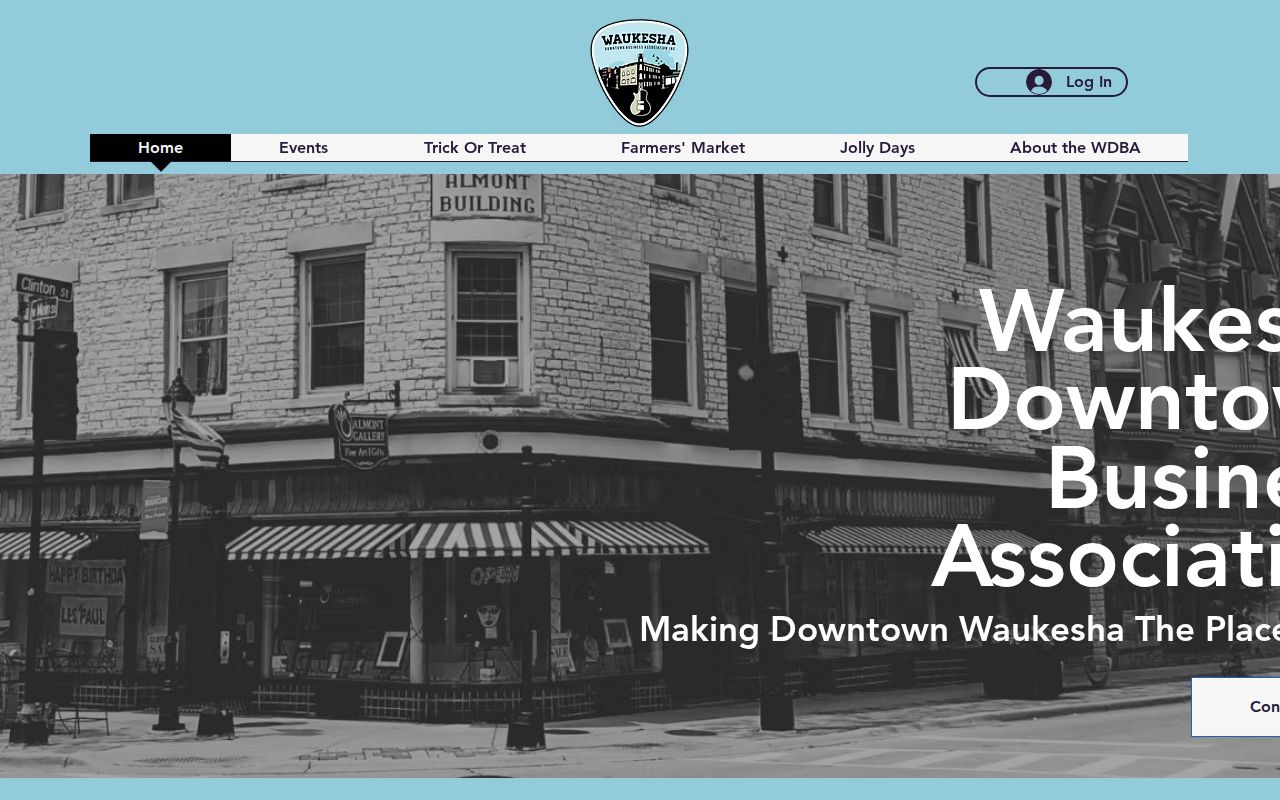
Its events and public contacts add local context, while membership or activity never establishes residence at a downtown address.
Waukesha Neighbor Voter Limits
MyVote Wisconsin is a self-record service. Its address form asks for street address, unit, city, and ZIP, but it does not publish an ordinary list of every voter on a block. A non-match should go to the municipal clerk rather than prompting guesses about nearby households.
Wisconsin's public voter file has a separate request and fee path through Badger Voters. Permitted name, address, and participation fields may be available, while birth date, driver-license number, and Social Security number are excluded. Confidential electors are protected. A voter file is also not a census: it omits people who are not registered and says nothing about all occupants of a parcel.
Compare Waukesha Neighbor Sources
Official sources and commercial neighbor tools answer different questions. County systems publish records created for taxation, mapping, elections, or public meetings. Commercial tools may combine public fragments, bought data, and user entries. Their address matches can be stale or merged with the wrong person, and paid access does not make a result official.
| Source type | Best use | Main limit |
|---|---|---|
| County parcel and tax systems | Confirm a parcel, owner field, civil division, and source date | Ownership is not occupancy |
| District and meeting records | Understand wards, services, projects, and named public roles | Not a resident directory |
| Community organizations | Find public events, contacts, and membership rules | Private rosters remain private |
| Commercial compilation | Possible lead for later official checking | May be stale, mixed, or paywalled |
Keep only the narrow fact needed, along with its source and date. A name from a compiled result should return to a county, municipal, court, library, or association source before use.
Historic Waukesha Block Context
The Wisconsin Historical Society's 1871 Waukesha map joins lot numbers, owner names, roads, railroads, buildings, and business-directory material. It can bridge a modern parcel card to a block before the current address grid. The map is a dated snapshot, so it cannot identify current occupants.
Later city directories and public library databases may connect an address with an occupant in a stated year. Waukesha Public Library provides FamilySearch Affiliate access, regional and local newspapers, and HeritageHub obituaries. Exact local reverse-directory runs still need library verification. Keep a historic lot number, street spelling, directory year, and municipality together to avoid forcing an old entry onto the wrong modern parcel.
Protect Waukesha County Neighbors
A visible parcel does not make every household fact public. Renters, family members, utility customers, delivery recipients, minors, sealed-case participants, and juvenile parties may not appear in open records. Do not seek driver-license or private contact data as a shortcut. Published meeting packets show a person in a public role at a date, not all people at that person's home.
Wisconsin Safe at Home supplies an assigned address to eligible people and can protect actual location information. Confidential electors under Wis. Stat. §6.47 are excluded from ordinary disclosure. Never use parcel, voter, court, or group clues to reverse-engineer a protected address. When a record seems wrong, contact its custodian instead of confronting the person named.
Lawful use. Use block records only for lawful personal research, civic context, or safety awareness. Never watch, harass, threaten, or expose another person.