
Walk a Waukesha County Street
A street directory search works best as a chain. An address can identify a tax parcel and its civil division. That parcel can lead to a legal description, a current tax contact, and recorded instruments. None of those facts alone says who sleeps at the address today. Waukesha County Tax Listing does not display an owner-name search on its opening form, so the address or tax key is the practical starting point. Keep each role distinct: a tax contact is not always a resident, a deed party may be a former owner, and a permit applicant may only have managed a project.
- Enter the address in County Tax Listing. Save the tax key, parcel description, municipality, and source date.
- Open the parcel in the Waukesha County Map Atlas. Check adjacent parcels, civil-division lines, rights of way, and any historic-parcel context.
- Follow the map or tax link to the Register of Deeds. Compare the legal description before treating an instrument as part of the same parcel.
- For City of Waukesha property, search the municipal permit portal by site address or parcel ID. Treat an owner or applicant as a project clue, not an occupant.
- For an older household, consult directory and archive sources. Use MyVote only for the requester's own voter record, never as a street-wide list.
This five-part street walkthrough gives different levels of proof. Parcel and deed records are strong evidence of ownership. Permits document work and dates. Historical directories can associate a household with an address in one publication year. A present resident still may not appear in any of them. When the goal changes from the current address chain to old occupants, the Waukesha County past-resident trail carries the search backward.
Format Waukesha County Addresses
The county tax search accepts either a tax key or an address. Spaces and punctuation come out of a tax key. The county example changes BR C 1234.555 to BRC1234555. Grid-style addresses may be entered as a compact number such as S99W22910, without a street name. Those local forms matter. A street directory miss can result from punctuation, a direction, or a postal name that differs from the parcel's civil division.
| County control | Input | How to use it |
|---|---|---|
| Tax Key or Address | Text | Supply one value; remove tax-key spaces and punctuation. |
| Addresses / Tax Keys | Choice | Select the mode in Advanced Search. |
| Match On / Match Type | Dropdowns | Record the selected labels because the full option lists were not documented. |
| Include Historical Results | Checkbox | Add available older results; the portal does not state a complete year range. |
| Include Personal Property | Checkbox | Keeps personal-property results separate from real estate. |
| Owner name | Not visible | The county landing form does not offer a person-name field. |
The live county tax interface shows the basic box, Advanced Search, historical-results option, and property controls. The image below preserves that entry point as captured. It also shows why an exact address or tax key, rather than a resident's name, drives the Waukesha County street directory workflow.
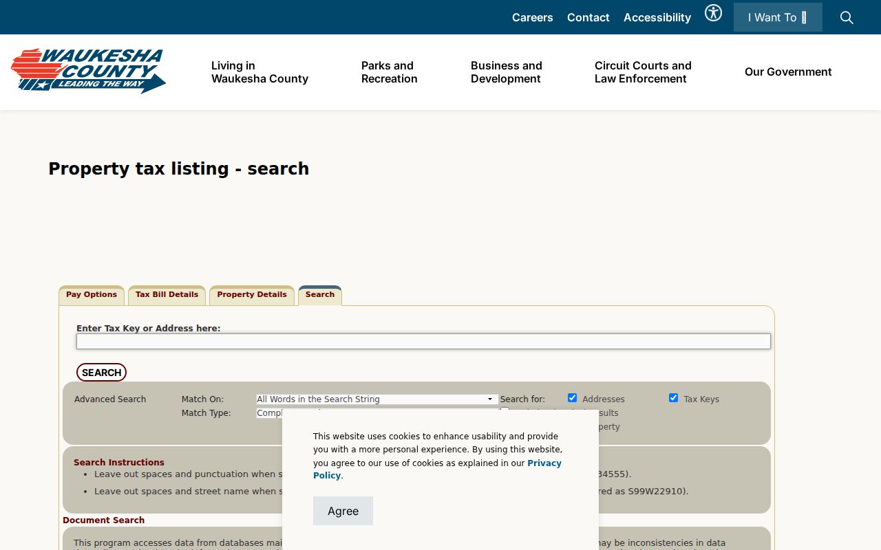
After opening a result, note its source date and municipality. County and local databases update on different cycles, and the tax site warns that inconsistencies can occur.
Map Waukesha County Street Parcels
Map Atlas turns one address into a row of parcel shapes. The county tax-parcel service includes civil divisions, annexations, rights of way, simultaneous conveyances, historic tax parcels, and retired plats. These layers can explain why two neighboring addresses have different municipal custodians, or why an old tax key no longer works. Historic parcel coverage reaches roughly to the mid-2000s in the service description, while current boundary data may lag a Register of Deeds filing by about 90 days.
The public Map Atlas is the visual bridge between an address and the parcel's tax and recorder links. Its captured landing view appears below. Use the live layer metadata when a boundary date matters, since the screenshot is evidence of the interface, not proof of a parcel's current legal status.
Click and record parcels one at a time. GIS geometry is a discovery aid, not title proof, and a whole-street export or resident list was not verified.
Note: Check the civil division for every parcel because a Waukesha postal address may belong to a city, village, or town custodian.
Waukesha County Street Record Set
Each address-keyed source answers a narrow question. The table separates the keepers, outputs, and access paths so a street directory result is not asked to prove more than it can. Online searches are only one channel. Older deeds require index books or office help, municipal departments hold many permits, and licensed library databases may require a library card or in-building access.
| Record Set | Keeper | What It Shows | Access |
|---|---|---|---|
| Tax parcel | County Tax Listing and municipal assessor | Tax key, situs address, parcel description, values, and available owner or mailing fields | Free county address search; municipal card may add detail |
| GIS parcel map | County Land Information and city GIS | Parcel geometry, civil division, annexations, districts, and historic layers | Public viewers and data services |
| Recorded documents | Waukesha County Register of Deeds | Legal description, parties, instrument, type, and recording date | Remote index from 1994; older books, office search, and paid images |
| Voter record | Wisconsin Elections Commission and municipal clerk | The requester's registration, address, officials, and voting history | MyVote self-lookup; public-list request is separate |
| Building permit | City of Waukesha or other municipality | Permit, parcel, issue date, owner or applicant, and site address | City portal or direct municipal request |
| Historical directory | Waukesha Public Library and archives | Published occupant or household at an address in a given year | Library databases, shelf volumes, and archive help |
A parcel number ties tax, map, deed, and permit systems together. A street name ties historical publications together, but it is less stable. Save the legal description and civil division when those appear. They can survive a renumbering, annexation, or road-name change that breaks a plain address search.
Waukesha County Deeds by Address
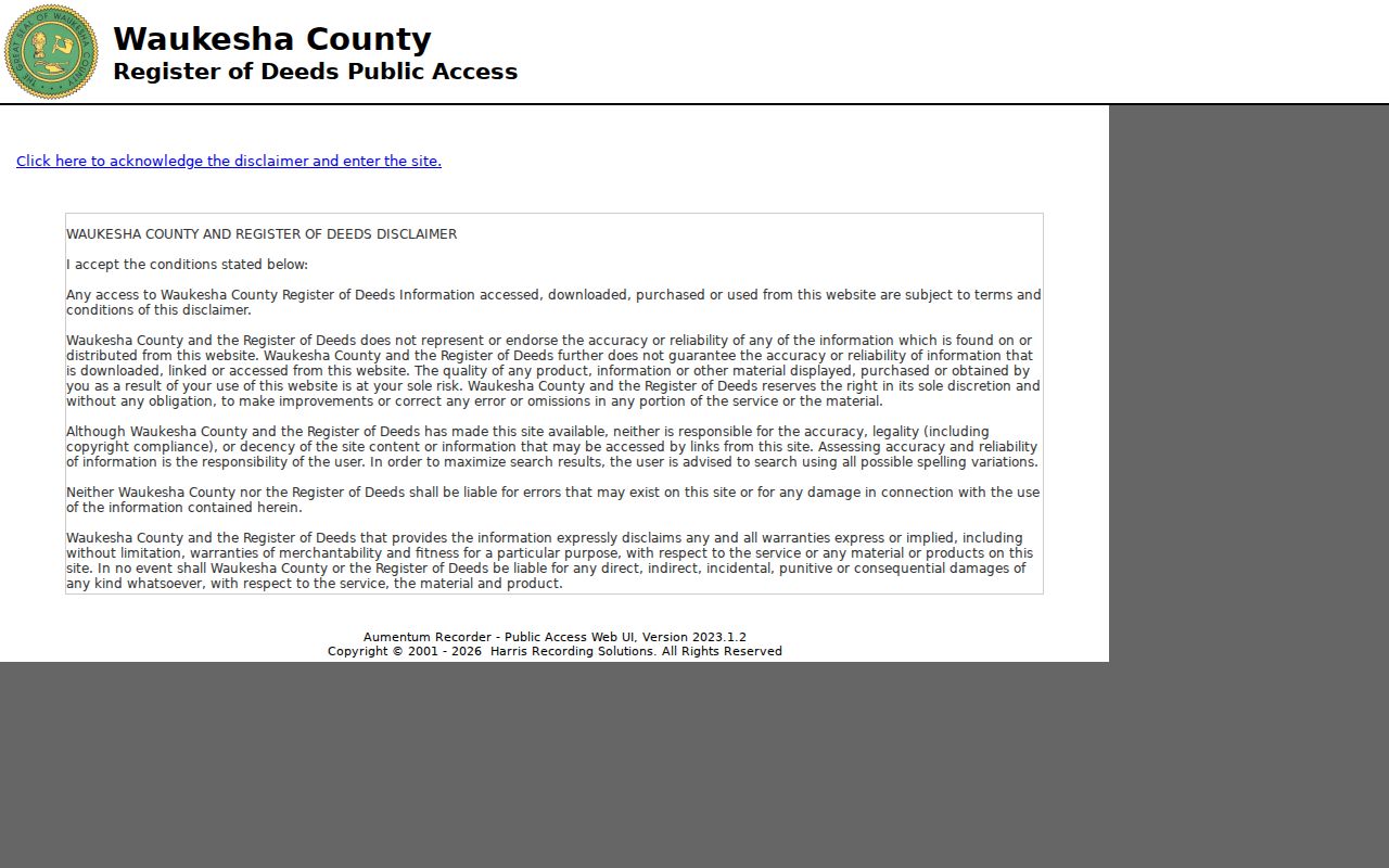
The Register of Deeds public system begins with an acceptance screen, then offers Recorded Documents and Search Real Estate Index. Remote users can search legal-description paths such as subdivision, condominium, metes and bounds, Certified Survey Map, instrument number, and book/page. Remote name search is restricted by local ordinance. In-office name search remains available, which makes the counter at 515 W. Moreland Boulevard an important fallback for a grantor or grantee search.
The online index covers 1994 to the present under the county guide. Documents back to 1953 may exist in the repository, but older work can require index books, legal-description tools, or staff help. The Register of Deeds public-access portal shown below is therefore an entry point, not a complete street directory.
A GIS link only returns documents indexed to that tax key. No result may mean the link is missing, not that no instrument exists. Search the legal description or ask office staff before closing the trail.
Waukesha Street Permit Clues
The City of Waukesha Permit Management search adds a project timeline to an address. Its controls include municipality, issue-date range, parcel ID, original owner, exact parcel match, site and mailing addresses, permit or application number, type, status, and owner first and last name. Returned columns are Permit, Parcel, Issued, Owner(s), and Site Address. The portal's historical coverage is not stated, so an empty search should lead to the municipal building department rather than a claim that no permit exists.
Permit evidence dates work on a building and may name an owner from that period. It does not prove residence. Outside the City of Waukesha, use the municipality shown on the parcel and request its records. The statewide DSPS approved-UDC search is another limited check, but it does not replace municipal permit or code files.
Decode Waukesha County Street Terms
Four terms recur in a by-address search. Defining them prevents a mailing address from being mistaken for the land itself.
- Parcel
- A mapped unit of land used for tax and land-record work. One street address may not always equal one parcel.
- Situs address
- The location of the parcel or building. It can differ from the mailing address used for tax notices.
- Plat
- A recorded map that divides land into lots and blocks. Retired plats can help match an old description.
- Criss-cross directory
- A directory arranged by address or telephone number instead of only by surname. Exact Waukesha County runs still require library confirmation.
The legal description is often the best bridge between systems. It can connect a modern parcel to a recorded subdivision, lot, block, survey map, or section-township-range description even when street wording has shifted.
Use the street directory as an evidence log, not a roster. For each Waukesha County address, note which system supplied the parcel, which office holds the source, and whether the result describes land, an owner, a filer, or a published occupant. That small habit prevents names from sliding between roles. It also makes a by-street review easier to update when tax data, map layers, or recorded instruments change.
Historic Waukesha Street Context
The Wisconsin Historical Society's 1871 Waukesha map combines roads, lot numbers, owners, rail lines, buildings, and business-directory material. Its captured view appears below. That mix makes the map useful when a modern address has no direct match in an old deed or directory.
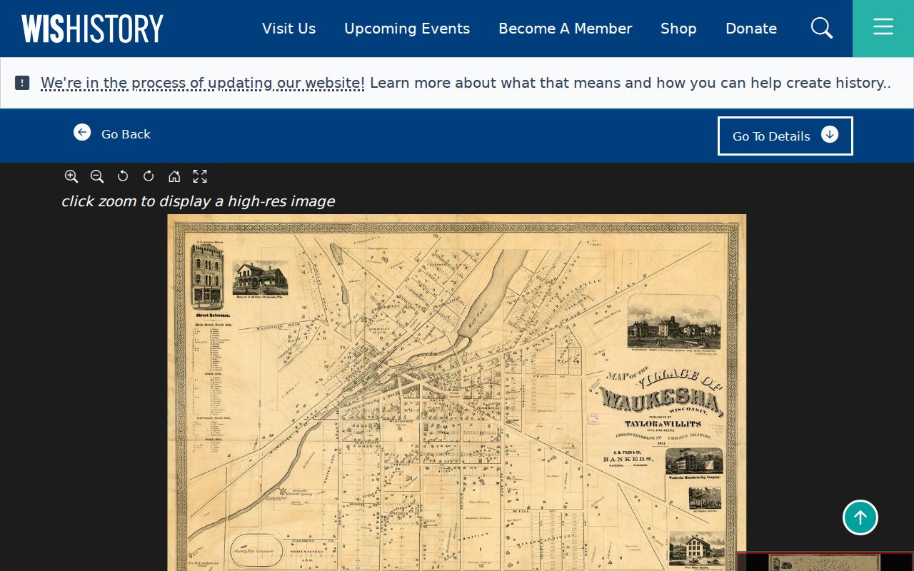
Match the old lot or plat to later parcel records before assigning a historical name to today's building. Waukesha County separated from Milwaukee County in 1846, and the earliest deed volumes add another wrinkle: volumes A through G for 1839 to 1855 were recorded in Milwaukee County.
There is no sourced countywide street-renumbering date or complete archive-loss story. Test directions, road-type abbreviations, historic village and town names, and post-office wording, then label uncertain matches as possible rather than confirmed.
Limits of Waukesha Street Records
A Waukesha County street directory assembled from official sources is incomplete by design. A parcel record may name an owner or tax contact but not a renter, child, guest, or every member of a household. MyVote is an individual self-lookup, not a public block list. A separate public voter-file request follows Wisconsin law, fees, and exclusions; birth dates, driver's-license numbers, Social Security numbers, and confidential-elector data are not ordinary public fields.
Safe at Home participants may use assigned addresses, and confidential electors receive added protection. Sealed cases, juvenile material, private utility accounts, and motor-vehicle address data are not shortcuts. If an official portal omits a person, do not try to reverse-engineer a protected address from scattered records.
Lawful use. Use Waukesha County address records for lawful personal research, property history, and civic questions. Never use them to stalk, harass, intimidate, or expose a protected person.
Commercial people-finding tools may merge public and purchased data, yet those compilations can be stale or attach a name to the wrong address. Verify narrow facts with the custodian that created the record. Keep a source date and avoid publishing private household details.