
Waukesha County ZIP Coverage
The county's 2020 Directory of Public Officials lists 26 post-office and ZIP associations. It is a useful official snapshot, not a boundary map and not proof that each delivery area lies wholly inside the county. Several post offices have more than one code. For a current address, the USPS result controls the delivery ZIP while county GIS identifies the civil division.
| ZIP Code | Areas Covered | Post Office | Notes |
|---|---|---|---|
| 53005, 53008, 53045 | Brookfield | Brookfield | Verify county overlap by address |
| 53007, 53018, 53029 | Butler, Delafield, Hartland | Named local post offices | One association each |
| 53051, 53052 | Menomonee Falls | Menomonee Falls | Two associations |
| 53046, 53056, 53058, 53064 | Lannon, Merton, Nashotah, North Lake | Named local post offices | One association each |
| 53066, 53069, 53072, 53089 | Oconomowoc, Okauchee, Pewaukee, Sussex | Named local post offices | One association each |
| 53103, 53118, 53119, 53122, 53127 | Big Bend, Dousman, Eagle, Elm Grove, Genesee Depot | Named local post offices | One association each |
| 53146, 53151 | New Berlin | New Berlin | Two associations |
| 53149, 53150, 53153, 53183 | Mukwonago, Muskego, North Prairie, Wales | Named local post offices | One association each |
| 53186, 53187, 53188, 53189 | Waukesha | Waukesha | Four associations; verify exact address |
No official source located a ZIP-only institution, PO-box-only local code, or realignment year. Those claims should not be inferred from the table. The list may also omit delivery areas that cross the county edge, so exact-address verification remains necessary.
Verify Waukesha ZIP Codes with USPS
USPS ZIP Code Lookup checks the current postal assignment for an exact address. Enter the complete street line and delivery city rather than searching only a place name. Preserve apartment or unit details when known. USPS answers a mail-routing question, while the county answers parcel and jurisdiction questions.
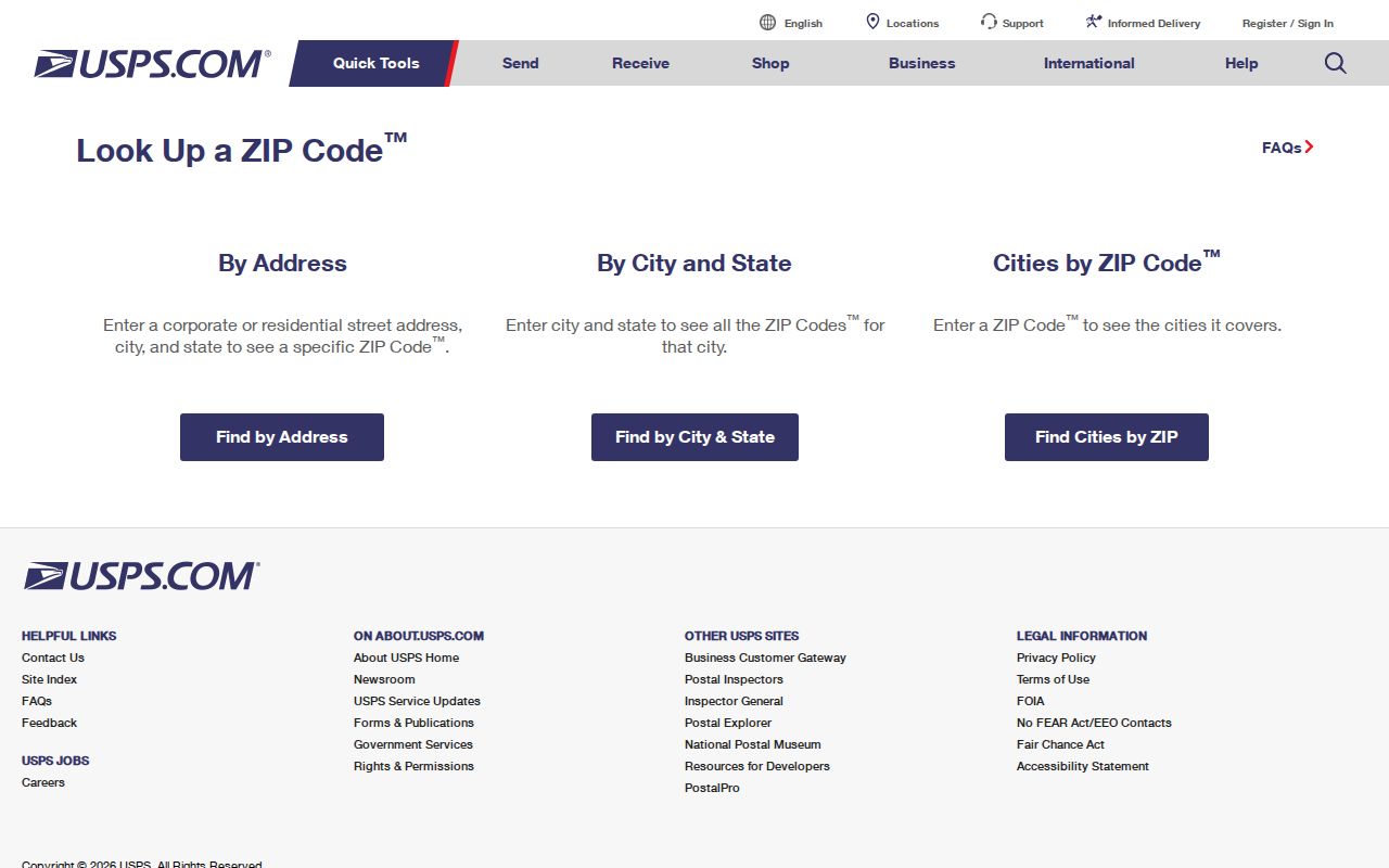
The captured lookup is the correct source for present delivery coding, followed by the county map for municipal context.
Twenty-Six ZIPs, Thirty-Four Municipalities
Waukesha County Tax Listing covers 34 municipalities, while the county directory lists 26 post-office and ZIP associations. That comparison is the clearest warning against treating postal geography as local government geography. One post office can serve addresses in more than one civil division, and a municipality can use more than one postal code.
This distinction affects the next record request. The municipal clerk, assessor, permit office, police agency, court, school district, and fire district can depend on the civil division, not the delivery city printed on an envelope. Check the parcel before contacting an office.
Waukesha ZIP Fields in GIS
The county tax portal exposes no visible ZIP filter. The underlying GIS parcel-building schema does include ZipCode, OwnerZip, and address fields, but that does not mean the public interface offers a countywide ZIP query. Owner ZIP may be a mailing address and can differ from the property's situs, meaning its physical location.
| Field or source | What it represents | Public search status |
|---|---|---|
| ZipCode | Parcel or building address ZIP in GIS schema | Schema field; public filter not confirmed |
| OwnerZip | Owner mailing ZIP | Do not treat as parcel ZIP |
| Tax Listing | Tax key or address | No visible ZIP field |
| MyVote address mode | Street, city, and ZIP for the requester | Self-lookup, not a ZIP-wide roster |
A sound Waukesha County ZIP code directory must state those limits instead of promising a bulk list that the official interfaces do not provide.
Find Waukesha Residents by ZIP
Use a ZIP to narrow geography, then switch to a lawful record source built for the actual task. No inspected official portal supplies a general public roster by ZIP. MyVote checks the requester's own registration, and the tax portal searches a tax key or address rather than a visible ZIP field.
- Verify the full delivery address through USPS and record the returned ZIP.
- Open Waukesha County Map Atlas, locate the address, and note the parcel and civil division.
- Use County Tax Listing with the address or tax key. Do not substitute the owner mailing ZIP.
- For a registration self-check, use MyVote with street, city, and ZIP; refer a non-match to the municipal clerk.
- Once the area is narrowed, search the exact road through the street-level workflow.
The Waukesha County street directory takes over when the task shifts from a postal area to one named road. It explains address and parcel records without turning the ZIP into a false resident list.
Waukesha Grid Address ZIP Searches
Grid-style addresses such as S99W22910 are a local search quirk. Keep the directional letters and digits together, and test the county tax-search formatting rule. A historic directory might spell out a direction or street type, while a current parcel system may expect the compact grid number. Save both forms in research notes.
Do not alter the address merely to force a match. First verify it with USPS, then try the parcel map and tax search. If a historic source lacks any ZIP, use the street, ward, lot, plat, legal description, and mapped location instead of assigning today's code to the old record.
Historic Waukesha Records Before ZIPs
Old Waukesha directories and maps often have no ZIP field. The 1871 village map works with lot numbers, owners, roads, buildings, and plat additions. Later directories may rely on street address or post-office place. Preserve that period language. A modern ZIP can be added as a clearly dated cross-reference only after the parcel is matched.
This protects against false continuity after annexation, street changes, and parcel retirement. County GIS includes civil divisions, annexations, historic tax parcels, rights of way, and retired plats, but layer dates vary. Cite the map date and do not claim a historical boundary that the source does not show.
Waukesha ZIPs Versus City Limits
ZIP code boundaries route mail; they do not define Waukesha County's cities, towns, or villages. Keep four fields separate: the USPS delivery city, ZIP code, county, and civil-division municipality. That small habit sends a permit or clerk request to the right place and prevents a postal label from becoming a false legal boundary.
- ZIP code
- A USPS delivery area. It is not a municipal border.
- ZIP+4
- The base ZIP plus four digits that narrow mail delivery to a smaller segment.
- PO-box ZIP
- A code reserved mainly or wholly for post-office boxes. None was confirmed locally in the research.
- Unique ZIP
- A code assigned to one high-volume organization. None was confirmed for Waukesha County.
- Carrier route
- A postal delivery route inside a ZIP, not a public list of households.
Use Wisconsin Public Records Law, Wis. Stat. §§19.31-19.39, when an identified custodian holds a responsive public record. State law does not turn private household data into an open ZIP directory. Safe at Home assigned addresses and confidential-elector protections must remain protected.
Waukesha ZIP Lookup Fallbacks
When a portal rejects the address, move through the access channels in order. First check USPS spelling and ZIP. Next inspect Map Atlas and County Tax Listing. If the parcel lies in the City of Waukesha, the city parcel inquiry can add local map context. For other cities, towns, and villages, use the municipality named by the civil-division layer and contact its clerk or assessor.
A public-record request can seek an identified municipal or county record under Wisconsin Public Records Law. Describe the record, date range, address, and office rather than asking for all people in a ZIP. Requests may be made by any person, and the response standard is as soon as practicable and without delay, subject to exceptions and the balancing test. The county's online services directory also routes selected tax, document, and maintenance searches, though some functions may require a login.
Record Waukesha ZIP Evidence
A reliable ZIP code directory result keeps the value and its source together. Save the exact address submitted to USPS, the returned delivery city and ZIP, the date checked, parcel or tax key, and civil division. If an owner mailing address appears, label it separately. Do the same for a historic directory entry, which may show only a post office or street and no postal code.
Portal data changes on different cycles. The tax system warns about data quality, and parcel descriptions, values, recorded documents, and postal assignments need not update at the same time. A screenshot can preserve what the screen showed on a given date, but it does not become a certified record. Confirm the key fact with its custodian before using it for an estate, family-history, seller-verification, or civic research question.